Advanced Visible and Near Infrared Radiometer type 2 (AVNIR-2)
Source: http://spacespin.org, accessed on 30th Oct. 2011 Source: http://www.eorc.jaxa.jp, accessed on 30th Oct. 2011
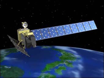
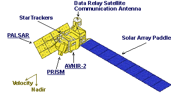
AVNIR-2 is a visible and near infrared radiometer onboard ALOS. AVNIR-2 is a successor to AVNIR that was onboard the ADvanced Earth Observing Satellite (ADEOS), which was launched in August 1996. Its instantaneous field-of-view is the main improvement over AVNIR. AVNIR-2 also provides 10m spatial resolution images, an improvement over the 16m resolution of AVNIR in the multi-spectral region. Improved CCD detectors (AVNIR has 5,000 pixels per CCD; AVNIR-2 7,000 pixels per CCD) and electronics enable this higher resolution. The pointing angle of AVNIR-2 is +44° and -44°. AVNIR-2 coverage for the SMAPEx study area is summarised below. AVNIR-2 data can be downloaded from JAXA.
Instrument
Advanced Visible and Near Infrared Radiometer type 2
Spacecraft
Advance Land Observing Satellite (ALOS)
Launch date
24th, Jan. 2006
Design life
3 - 5 years
Orbit
Sun-Synchronous Sub-Recurrent, at an angle of 98.16°, at altitude of 691.65km (at equator).
Spacecraft operations control centre
JAXA and JAROS
Channel and wavelength (micrometers)
4 VNIR bands (0.42 - 0.89)
Incidence angle(°)
±44
Swath (km)
70
Spatial resolution (m)
10 at nadir Temporal resolution
Repeat Cycle: 46 days, Sub Cycle: 2 days
AVNIR-2 overpass time
The AVNIR-2 overpass time for the SMAPEx study area is provided in the table below, determined from a Fortran program based on the NORAD data. Date and time are in UTC.
●=full AVNIR-2 coverage of airborne box; ○=partial AVNIR-2 coverage
●=concurrent; ●=non concurrent
No coverage was found during 5th-10th July, 2010.